->

03 August 2010

Open Street Map now in Bing Maps

Open Street Map now in Bing Maps

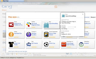
Open Street Map is now available in Bing Maps via the 'Open Street Map' App

Open Street Map now in Bing Maps
MapNik Tile Render via Bing Maps (OSM) APP


Open Street Map now in Bing Maps

http://www.bing.com/maps/explore/#5003/0.6002=
q:NYC:nelat:51.6120377517871:nelong:0.18654357910159:
swlat:51.4079622462129:swlong:-0.446543579101535:nosp:0:adj:0/5872/style=Mapnik&lat=40.65415&lon=-74.024291&z=11&pid=50735

In Addition there are some improvements to Bing Maps Explore:

  • Appearance: Cool colours create a more visually appealing backdrop that helps content ‘pop’ on the map, providing clear differentiation for pushpins, labels and red, yellow and green traffic overlays. 
  • New labels: Larger fonts correspond to larger roads, making it easier to identify major streets and throughways. Crisper labels eliminate the need for bolding and less-attractive glows, allowing users to quickly find locations in a relevant format.
  • Improved international coverage: Data updates deliver improved road and street detail across Central and Eastern Europe, the Middle East, Oceania and Asia.
  • Dynamic Labels (beta): This innovative map navigation allows you to quickly zoom to a region or location on the map with just a few clicks, making it easier to identify and explore areas or neighborhoods of a city. Turn on the dynamic labels beta from the map style selector on bing.com/maps/exploreand labels become clickable.

Labels: , , ,

01 April 2010

Download Ordnance Survey Data

Download Ordnance Survey Data

updated (servers now active & running!)

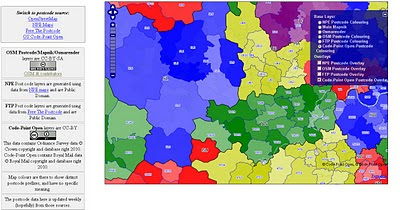
Pretty Postcodes
Code-Point Open

Codepoint Open - OSM Rendered

http://random.dev.openstreetmap.org/postcodes/?layers=000F0F0FBT
(development - may change at anytime)

Problems downloading on the OS OpenData site?
Alternative site: http://parlvid.mysociety.org:81/os/
Donate if you can (thanks)

now includes:
Code-Point Open
  • NationalGrid ↔ WGS84: AGPL Perl code, GPL PHP code
  • CSV headers: Postcode, Quality, PO box indicator, Delivery points stuff x 7, Easting, Northing, Country, NHS region, NHS health authority, County, District, Ward, Postcode.
  • WGS84 edition – with latitude and longitude instead of National Grid, and empty columns removed (so CSV headers are: Postcode, Quality, Latitude, Longitude, Country, NHS region, NHS health authority, County, District, Ward).
:) thanks @jonobennett

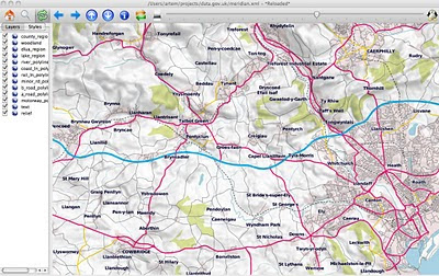
OS Meridian2 xml_rendered in OSM Mapnik
Fast implementation above Meridian2 rendered in OSM Mapnik

Another mashup using the OS 50k Gazetteer
A Tour of the OS 50k Gazetteer Linked Data
http://www.ldodds.com/blog/2010/04/a-tour-of-the-os-50k-gazetteer-linked-data/


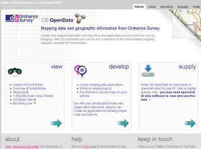
Ordnance Survey Open Data


Ordnance Survey Open Data Download

Labels: , , , ,

13 September 2007

MapNik - OpenStreetMap - Google Maps API (Custom Tile)

MapNik - using OpenStreetMap in Google Maps API (as a Custom Tile)

Mapnik Map Transition with Google Maps
MapNik with OpenStreetMap (Oxford,UK) using Google Map API (Custom Tile) works really well. (gif transition created by Mapperz)

"Mapnik is a Free Toolkit for developing mapping applications. Above all Mapnik is about making beautiful maps. It is easily extensible and suitable for both desktop and web development."


UPDATE Starting from 0.4 Mapnik runs on Linux, Mac OS X (10.4.9), Win32 and FreeBSD


Mapnik can read ESRI shapes, PostGIS databases and TIFF rasters
more?
"As always, there are lots of things in the pipeline"

Features

  • Projection transformations
  • Multiple named styles in WMS
  • Line following' text labels
  • 'Shield' symbolizer
  • Feature querying
  • Character encodings support
  • GetFeatureInfo with text/plain and text/xml output
  • Support for right to left languages
If you want to see the functionality of Google Maps and the more detailed (less in some respects)
go to the Demo Area of MapNik website for more examples.

There are other Maps available (a good working one it Victoria, British Columbia)
http://mapnik.org/maps/


*Mapperz used Adobe Image Ready to visualize the cartographic differences between MapNik and the Normal tiles available in Google Maps API

Labels: , , , , ,