->

16 October 2009

The Running Map

The Running Map

A useful map for the likes of runners, joggers, cyclists, hikers, horse riders & walkers.
A clean fast way to prepare for your running routes

Running Map Route in Miles
Nice clean interface, self explanatory - simple to use map.
Even a show elevation option displays at the bottom of the map.

Based in Flash (Flex) and using the Yahoo Flex API
http://developer.yahoo.com/maps/flash/flexGettingStarted.html

The speed of the map load is much improved and the tools and functions (ie switching from miles to kilometres) is extremely fast.
The very helpful 'save route' is a permalink like:
http://www.runningmap.com/?id=145338
(the map above) WITHOUT requiring to have a user account.
Though having a registered user account does give you more control on multiple routes.
Tip: is if you have previous permalinked route(s) and then sign up - you can apply those routes to your newregistered account.

"RunningMap.com is a website for runners, cyclists, hikers or outdoor enthusiasts who want to plan, save and share their routes. Since 2003 Runningmap.com has been helping runners determine the distance of their routes in a way that was not previously possible."

more helpful information and guide is available at
http://www.runningmap.com/news/how-to-get-started-with-runningmap/
http://www.runningmap.com/news/faq/

Running Map - Trackometer on iPhone
If your interested in this and also have an iPhone then you will be wanting to try out
http://www.runningmap.com/news/iphone/

or the direct link on itunes.


Labels: , , , , , , , ,

20 September 2007

ArcWeb Explorer (Beta) 2.0

ArcWeb Explorer (Beta) 2.0
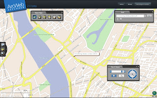
ArcWeb Explorer 2.0 application, which offers powerful Web map rendering with desktop-like functionality.

ArcWeb Explorer 2 (beta) - Rotated Map
source: ESRI

The rotating map is a clever bit of code - the text flips (renders) itself when it goes beyond 180 degrees.

ArcWeb Explorer 2.0 Application

ArcWeb Explorer 2.0 Flex API

ArcWeb Explorer 2.0 JavaScript API

Exposes ArcWeb Services functionality through easy-to-use widgets

Enables developers to build and/or customize applications

Offers the use of a powerful subset of ArcWeb Services functionality

Offers the ability to quickly find locations, pan and zoom, and choose a map type Provides access to all ArcWeb Services Provides access to ArcWeb Services content
Provides access to street, street tile, aerial imagery, hybrid (integrated street and aerial), shaded relief, and topographic maps Allows for easy and powerful ArcWeb integration inside Adobe Flex Builder Enables easy integration of mapping functionality and content into HTML Web applications
NOTE: The Flex API is designed specifically for use within Adobe Flex 2. The JavaScript and Flex APIs are not designed for use within Adobe Flash Professional.
source: ESRI

To use this service you will be required to login in.
ArcWeb 2.0 Home Page

ArcWeb Explorer JavaScript Example
JavaScript Sample

ArcWeb Explorer Flex Example
Flex Example

Both have the code generated on the fly - therefore it is faster to get up and running with your own apps and data.

Is this to challenge the likes of Google Maps, Virtual Earth and Yahoo Maps API's?
We will see...

Mapperz

Labels: , , , , , , ,