The Met Office (Google Maps) Weather
The Met Office (Google Maps) Weather
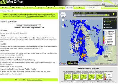
The Met office are experimenting with the Google Maps API - this is a very interesting move. The results are quite impressive and this is a potentially a bold move and a great way to represent weather forecasting on the web.
This includes animating the weather for the next 24hrs using the time bar above the map.

Google Maps API with Meteorological Data overlayed to represent very visually the foretasted weather for the UK. Animation is controlled by the 'Play' Button.
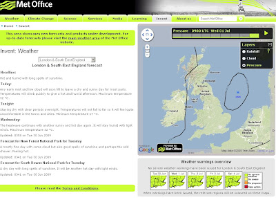
Not only is rainfall overlayed but isobars representing the pressure is also animated.

Isobars (Barometric Pressure) overlay on Google Maps
There is Temperature, Winds(strength/direction) missing currently, this is planned for the future and will be very useful for users.
This is an impressive experiment and greatly improves the very static generated images that currently dominated the Met Office Website.
Well done to all involved, this is what the public want.
The Met Office Google Map (Experimental)
Currently the BBC have Temperature and Winds [Flash required]
http://news.bbc.co.uk/weather/forecast/10209
Suggestions - Opacity Control - current radar blocks the background map.
Temperature and Winds layers would be very handy.
5 day forecast possible?
An a final request on the raw data - it possible to have a basic GeoRSS feed for budding developers to create weather overlays for their own maps
GeoRSS weather warnings?
Labels: Experimental, Google Map API, Pressure, Radar, The Met Office, UK, Weather


0 Comments:
Post a Comment
<< Home