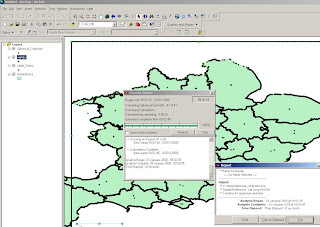
Graphics and Shapes Extension for ArcGIS
Graphics and Shapes Extension for ArcGIS 9.2
11/08/2008
A few extra functions have been added:
- Added “Build Polygon” function
- Added Polyline Azimuth options to “Calculate Geometry” tool.
- Multiple minor edits to code and manual, described in full in manual.
- Build 1.1.76 (January 10, 2008) Corrects a bug where the Spheroidal Length was being written to the wrong field.
http://arcscripts.esri.com/details.asp?dbid=15376
"Description: This extension includes a large suite of tools for calculating geometric attributes of vector features and for selecting and naming graphics. All tools are available at the ArcView license level."

Cleaner and Faster than conventional 'ESRI' Toolsets (and a progress bar that works)

Simple layout of functions - much better than those geoprocessing tools in the toolbox you can never find the name for.
Tools for Graphics
Graphic Elements to Shapes
Select Graphic Elements by Type
Select All Graphic Elements
Unselect All Graphic Elements
Flip Graphic Element Selection
Zoom to Selected Graphic Elements
Name Graphic Elements
Tools for Shapes
Convert Polygons to Label Points
Convert Shapes to Centroids
Convert Shapes to Spherical Centroids (detailed method explained in PDF)
Convert Shapes to Vertices
Convert Polylines to Polygons
Convert Polygons to Polylines
Split Multipart Features
Combine Features
Calculate Geometry
"Jeff Jenness is an independent GIS consultant specializing in developing analytical applications for a wide variety of topics, although he most enjoys ecological and wildlife-related projects. He spent 16 years as a wildlife biologist with the USFS Rocky Mountain Research Station in Flagstaff, Arizona, mostly working on Mexican spotted owl research. Since starting his consulting business in 2000, he has worked with universities, businesses and governmental agencies around
the world, including a long-term contract with the United Nations Food and Agriculture Organization (FAO) for which he relocated to Rome, Italy for 3 months. His free ArcView tools have been downloaded from his website and the ESRI ArcScripts site over 190,000 times."
Full and comprehensive documentation (in PDF Format)
http://www.jennessent.com/downloads/Graphics_Shapes_Online.pdf
Source:
Jenness, J. 2008. Tools for Graphics and Shapes: Extension for ArcGIS. Jenness Enterprises.
Available at: http://www.jennessent.com/arcgis/shapes_graphics.htm
Labels: ArcGIS, Extension, Graphics and Shapes, PDF, Productive, Time Saver


0 Comments:
Post a Comment
<< Home