GeoWizards 9.7 for ArcGIS
GeoWizards 9.7 for ArcGIS
One of the best all round third party extensions you can get for ArcGIS - lots of functionality is *Free*
"A collection of powerful data manipulation, topology and surface functions for ArcGIS "

New functions are:
Map To Google Earth
Feature Class to Google Earth
Import from Google Earth
Polygon Characteristics
Perpendiculars from points to polylines
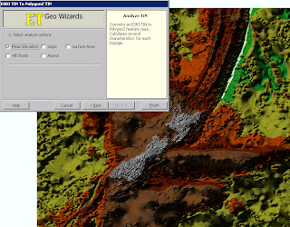
ESRI TIN To PolygonZ
Shape To ShapeZ
Point To Multipoint
Disperse Points
Random Points On Polylines
Random Points In Polygons

* New method (number of vertices) included in the Split Polyline function
* Create Centerlines and Aggregate Polygons functions added to the version for ArcGIS 8.x.
* Scripting and toolbox implementation of the Ungenerate function added.
* Two new options added to the Features To Bounding Rectangles function.
Improved is:
* Improved performance and ability to handle large datasets. Functions affected:
o Build TIN
o Build Thiessen
o Aggregate Polygons
o Create Centerlines
* The Clean Dangles function allows user defined Fuzzy/Cluster tolerance to be assigned - better user control over the function.
* Improved error reporting
* **Several Functions improved to handle datasets with Z or M values. In the previous versions the input Z(M) values were dropped .
Functions affected:
o Clean Polygons
o Clean Polylines
o Erase
o Batch Erase
o Clean Dangling Nodes
o Clip
o Batch Clip
o Advanced Merge
o Symmetric Difference
o Merge Layers
o Split By Location
Bugs fixed:
Point Intersection function produces incorrect results if a polygon dataset that have polygons with holes is used.
A licensing problem in the Scripting and ToolBox implementations in ArcGIS 9.0.
***Inability of some of the functions to handle correctly datasets containing true Arcs. Functions affected:
Build Polygons
Clean Polygons
***Some of the tools of the ToolBox implementation produce an Windows error if used within a script run from the command prompt. The results are derived, but the tool breaks up the script. Tools affected:
o Clean Polygons
o Clean Polylines
o Clean Dangling Nodes
o Clip
o Erase
o Advanced Merge
o Symmetric Difference
o Thin Points
o Aggregate
o Interpolate Contours
o Create Centerlines
* Point Angle And Position function fails in some cases when the source paint dataset is a PGDB feature class
***Several functions fail if the output is File Geodatabase:
o Points To Polylines
o Points To PolylinesZM
o Points To PointsZM
o Points To Polygons
o Points To PolygonsZM
o Batch Drop Z(M)
o Batch Clip
o Batch Erase
** Only the version for ArcGIS 9.0 and above
*** Only the version for ArcGIS 9.2
One of the best and most useful functions that this extension has is 'Create Shapefile' inside ArcMap to create a new point, line or polygon.
For more information and to download this extension go to:
http://www.ian-ko.com/
Labels: 9.7, ArcGIS, Extension, GeoWizards, Third Party


0 Comments:
Post a Comment
<< Home