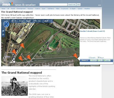
Grand National Map 2009 [Racecourse]
Grand National Map 2009 [Racecourse]

For the lead up to the 'Greatest' Steeplechase in the World - Via MSN [Virtual Earth]
"The 2009 race, run over a gruelling distance of four miles and four furlongs, takes place on April 4 with a field of around 40 thoroughbreds hoping to navigate 30 of Aintree’s famous fences and secure victory.
MSN News presents an interactive map of Aintree Racecourse featuring the famous fences and landmarks where the historic steeplechase has been won and lost.
Use the cursors to navigate your way around Aintree and utilise bird's eye view for a close up look at each key Grand National location."
http://news.uk.msn.com/media/map/
grand-national.aspx?cp-documentid=15355089
Grand National Moments
http://news.uk.msn.com/in-pictures/gallery.aspx?cp-documentid=15354822
Bird's Eye View available
http://maps.live.com/default.aspx?v=2&FORM=LMLTCP&cp=sxc8dygrp54n&style=b&lvl=1&tilt=-90&dir=0&alt=-1000&scene=29150710&phx=0&phy=0&phscl=1&encType=1
Labels: 2009, Grand National, Map, MSN, Racecourse


0 Comments:
Post a Comment
<< Home