MyMaps Helping to Map UK Floods
Update
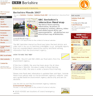
BBC Berkshire's interactive flood map
"The latest flood warning information, locations of emergency centres, photos, video and audio reports from our correspondents - all plotted on our interactive map of Berkshire."

BBC Berkshire Flood Map Feature
MyMaps helping Map UK Floods and useful up to date information

This MyMap records the flooding in Berkshire
The Power of MyMaps is use to display visually and geographically
Thanks to Ed Parsons for finding a map that is more useful and up to date than the Official Government Websites.

This map shows the bowsers available in Gloucester and Cheltenham
The cause of the flooding seems to be pointing at the jetsteam shifting south more than normal El Niño and La Niña (the rising and lowering of pressure and temperature in the pacific ocean)
could be possible causes, though human impact seems to cause more fluctuations in this natural process


Images: BBC and the Met Office
Labels: Bowsers, Flood, Flooding, Google, Jet Stream, Map, MyMaps, UK


1 Comments:
The flooding here in Rotherham in June providided an excellent opportunity for me to put my recently acquired GoogleMap skills to use. You can see it at
http://maps.google.com/maps/ms?f=q&q=s60+1td&layer=&ie=UTF8&om=1&oe=UTF-8&hl=en&msa=0&msid=101846479405045398341.000001136cf41eadb8273&ll=53.461482,-1.317673&spn=0.298427,0.63858&z=11
RiDO, the regeneration arm of Rotherham Council have been working with the Geographical Association on "living geography"
http://www.geography.org.uk/projects/livinggeography/
Post a Comment
<< Home