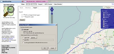
Open Street Map Routing, Directions & Export
Open Street Map Routing, Directions & Export
OpenStreetMap (OSM) gets even more powerful with directions and routing tools.
Find, View and Export your custom directions.
Designed Routes for:
- Car
- Heavy Goods Vehicles
- Goods Vehicles
- Public Service Vehicles (Buses)
- Motorcycles
- Bicycles
- Pedestrian
- Moped

Simply have a start and end location - midpoints/waypoints can be included.

Directions 'explain' your routes, like a satnav would, turn by turn, includes all road names.

Export, a very useful component lets you export in GPS exchange format (.gpx) or waypoints (.wpt) format.
The map with route (above) example:
http://nroets.dev.openstreetmap.org/demo/index.html?lat=54.6&lon=-3.8&zoom=5&layers=B000TTTTT&v=motorcar&adj=recommended&markers=!50.06626%2C-5.71482!58.64026%2C-3.06984
Click 'Recommended' to calculate the route.
Labels: .gpx, .wpt, Directions, Export Route, Open Street Map, Routing


0 Comments:
Post a Comment
<< Home