Flood Warnings Mapped - Environment Agency
Flood Warnings Mapped - Environment Agency

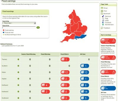
The Environment Agency are now mapping flood warning locations to a fairly high degree of accuracy. A step in the right direction and giving the public access to this information is way forward.

The main page now gives a overall summary for England and Wales.
Categories are:
- Severe Flood Warning
- Flood Warning
- Flood Watch
- All Clear
Clicking or searching on town/postcode will launch the mapping window where the user can pan and zoom around and see areas which show the actual location with a digitized polygon as the warning area. The mapping seems faster and clearer than a few years ago. Will be very useful when the floods come back. The site is update frequently and serves it's purpose well.
Yet to see a 'Severe Flood Warning' on the map.
You would think a flood warning to be yellow and severe to be red wouldn't you and an all clear be green?
http://www.environment-agency.gov.uk/homeandleisure/floods/31618.aspx
Labels: Agency, Environment, Flood Warning, Map, Polygon


0 Comments:
Post a Comment
<< Home