Open Street Map - Cycle Map
Open Street Map - Cycle Map

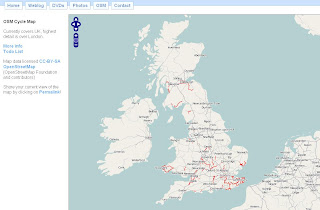
A nice implementation 'in progress' using free data. A positive move to community based mapping and you can see the results from this map.
The Cycle Map is based on data from the openstreetmap project. At low zoom levels it is intended for overviews of the national cycle network; at higher zoom levels it should help with planning which streets to cycle on.
Key:
- Routes in red are national cycle routes.
- Routes in blue are local cycle routes.
- Cycleways are shown in green and yellow.
- Toucan crossings are shown as green circles.
An up and coming event for UK Cartographers
Society of Cartographers - 43rd Annual Summer School 3rd - 6th September 2007
http://www.port.ac.uk/special/soc/
Programme Details are available from
http://www.port.ac.uk/special/soc/programme/
The 'Learning Technologist' Richard Treves interviews the Chairman of SOC has a blog called
http://googleearthdesign.blogspot.com
Labels: Cartographic Society, Cycle Map, Cycling, Events


0 Comments:
Post a Comment
<< Home