BlueGhost Integrates GeoRSS Maps
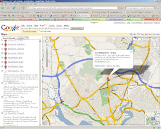
The BlueGhost Project nows uses Google Maps Enhancements to provide up to the minute Travel Incidents across the UK.

Live Feed Link
http://maps.google.co.uk/maps?q=
http://bbc.blueghost.co.uk/travel_data/locations.rss
Clicking on the blueghost.co.uk inside the icon info window will link to a new map of just that selected area.

Markers Represent there is a Incident and the Lines Represent the Road is Closed.
This works very well with live data and shows the full potential of GeoRSS feeds - providing users with up-to-date information.
Well Done to Michael Pritchard (Blueghost creator) for creating this and other very useful data feeds that are displayed in map form.
Other Blueghost maps
http://bbc.blueghost.co.uk/site4.php
(Traffic, Rail and Weather on Google Map - with nice icons)
Labels: Blueghost, Geo Map Overlay, GeoRSS, Google Maps, Live Feeds


0 Comments:
Post a Comment
<< Home