Cartographic Respresentations (4 of 5)
"A method of illustrating data so it can be viewed and understood"
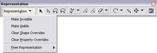
ArcGIS 9.2 Cartographic Respresentations - The Toolbar
Available through Tools>Customize >Representations Toolbar
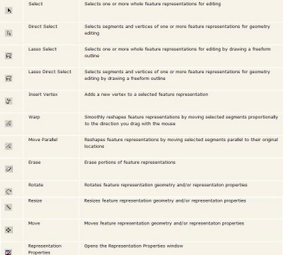
The Main Tools Explained
Before:
After:
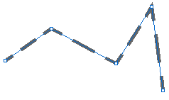
Representations can add lines on the direction change to make it more visual and cartographically correct. Representations can be edited independantly or group selections or in whole feature classes.
Source: ESRI Desktop Help 9.2 (Draft)
Labels: ArcGIS, Cartography, Toolbars


0 Comments:
Post a Comment
<< Home