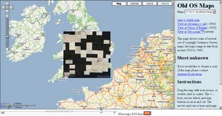
Ordnance Survey Maps in Google Maps
Ordnance Survey Maps in Google Maps

Use the slider at the bottom to adjust transparency between OS maps and Google maps
This site shows several out of copyright Ordnance Survey maps, the maps range in date from around 1925 to 1945. Copyright is released after 50 years.
It would be possible to have a seamless 1:10,000, 1:25,000 and 1:50,000 scale mode with up-to-date maps but you would be breaking Crown Copyright


0 Comments:
Post a Comment
<< Home