OpenSpace API - More Examples Please
OpenSpace API - More Examples Please
15/02/2008
Keep them coming... (and keep asking the OS for 1:25,000 Explorer Mapping!)

http://www.geothings.net/openspace/index.html
blog post
openspace-licences-limits-and-first-steps-plus-demo
OpenSpace API - More Examples Please
A few weeks on from the Ordnance Survey releasing the OpenSpace API there are a few that are taking up the small challenge and using the API to full effect.

Very Clever
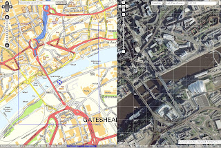
http://wheresthepath.googlepages.com/wheresthepath.htm
Note: Spilt screen half OS OpenSpace API and half Google Maps API Aerial imagery and is linked by location (pan and zooom can be enabled)
Blue transparent box shows the extent - switches between the maps.
Another Great Example

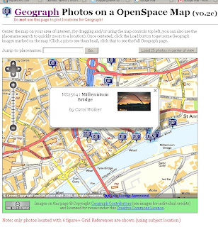
Geograph Photos on a OpenSpace Map (v0.2c)
http://openspace.nearby.org.uk/geograph.php
(Please do not use the page to plot locations for Geograph!)
Suggestions to make a better Mapping API - OS 1:25k would complete the set as there is a big jump between 1:50k mapping and 1:10k Streetview mapping.
Note: 1:25k is available on the Get a map service. Then you would be able to plan walking and hiking trips using the OpenSpace API. (1:25k has all public footpaths)
Not asking for 1:10k Rasters or MasterMap but there needs a scale.
There needs to be more Official Examples and better documentation with clear examples.
http://openspace.ordnancesurvey.co.uk/openspace/support.html
maybe and Advanced Section showing users the full potential of what can be done.
Working pages rather than static images with code would also be a helpful guide to newcomers to mapping API's.
Know of another OpenSpace API Map or have another suggestion? Then add yours via the comments.
Note:
"Newcastle-upon-Tyne" needs to be "Newcastle upon Tyne" or you will get an error.
Note:
"There will be a outage today 14th Feburary OpenSpace has a planned downtime from 5-6PM GMT today."
Labels: API, Exmaples, Maps, OpenSpace, Suggestions
3 Comments:
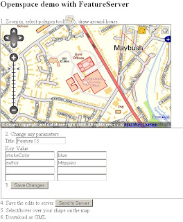
I've made an app of openspace and Featureserver, so a user can digitize around the buildings (a unique feature in openspace's maps) and download them as GML.
http://www.geothings.net/openspace/
The OpenSpace API requires HTTP Referrers. You may need to enable these on your browser and or internet security software before you can see any OS maps.
You may need to enable HTTP referrers on your browser and or internet security software before you can view maps through the OpenSpace API.
Post a Comment
<< Home