ArcGIS 9.2 Cartographic Representations (part 3 of 5)
ArcGIS 9.2 Cartographic Representations (part 3 of 5)
The science for Cartographic Representations.

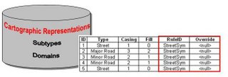
When Symbols are converted to Cartographic Representations this creates two new fields in the Geodatabase RuleID and Override. The RuleID is similiar to a Subtype containing a number. The Override field is a Blob (Binary Long Object) which contains all the represention information.
We have the Science now the technology is there to put the "Art" Back into Cartography

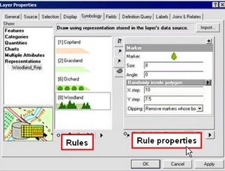
Users of Adobe Illustrator will familiar with the setup of the properties of CR.
The interesting and clever bit is that the real geometry is left untouched when using CR. It is like adding layers of graphics ontop of the feature classes. More than one CR can be applied to one feature class. This provides an excellent control at varing scales using the same features. Another example of the potentential is that the same features can be used for different types of mapping (tourist, motorist, walker maps etc.)

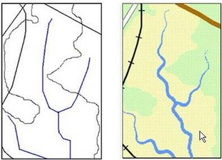
left:traditional un-symbolized GIS data. Right an example of CR in styling up features for a simple map at one scale.


0 Comments:
Post a Comment
<< Home