ArcGIS 9.2 Documentation Online - New Features
New Features in ArcGIS 9.2 (Added after the Pre-Release)

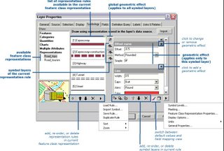
Cartographic Representations
Finally High precision data storage. (at last)
New Flicker command supports change detection and data comparison. (Added after Pre-Release)
Fill symbols with outlines in default ESRI style and others now draw up to 65% faster. (Added after Pre-Release)
New Results tab in ArcToolbox makes it easier to work with your geoprocessing history. (Added after Pre-Release)
Specify layer symbology as properties for input and output data in models. (Added after Pre-Release)
Full support for geoprocessing with ArcGIS Server. (Added after Pre-Release) Toolboxes can be published on the Web to provide geoprocessing services which can be accessed via ArcGIS Desktop.
New commands provide the same enhanced functionality available in the Desktop at 9.2: Add Data dialog, Go XY, Measure, Identify, Find, My Places, Swipe, Flicker (Added after Pre-Release), & ArcWeb Services route & place finding. Support
Also
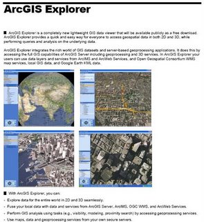
New free ArcGIS Explorer client
New lightweight GIS data viewer available as a free download. Supports 2D and 3D viewing of maps. Task-based user interface can be customized by developers to expose ArcGIS Server functionality. Fuse data from different sources together to create custom visualizations. Support for server-based data from ArcIMS, ArcGIS Server, ArcWeb Services and OGC WMS Support for shapefiles, file geodatabases, raster data, and Google Earth KML/KMZ.

Release Date 'Due Last Quarter of 2006'


0 Comments:
Post a Comment
<< Home