Ordnance Survey [resurrects] OpenSpace Mashup
Updated 20/05/2009
An the Winner is.... Gavin Brock - Well done to everyone who contacted the Ordnance Survey about this - now you can be proud of yourselves.

The tiles impressions limit has also been upped to 1,000,000 from 30,000.
[http://www.brock-family.org/gavin/google-earth/osmaps.html]
2009-05-19 (Tue)
We’re back!
"First I would like to thank you all for your support! I believe that your emails, posts and comments, regarding yesterdays blog post, made a difference. It’s great to hear from you – it’s what makes writing software for fun, erm.. fun!
I just received a detailed message from the Director of Products at Ordnance Survey, apologising for the communication regarding the disabling of the service. He explained, that this is not a “derived data issue“, but rather to do with the licenses:"
more here: http://gavcode.wordpress.com/2009/05/19/os-overlays-re-enabled/
Ordnance Survey Kills OpenSpace Mashup
update: Ed Parsons (former CTO at OS, now Google) mentions this mashup in his latest post
http://www.edparsons.com/2009/05/os-puts-the-no-back-in-innovation/

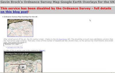
For a long time this site [http://www.brock-family.org/gavin/google-earth/osmaps.html] was straight forward and overlayed Ordnance Survey Maps in Google Earth.
Users could view the Maps which were overlay-ed on the Google Earth Terrain.
The 3D view helped visualize users with the surrounding features as well as giving them familiar maps as reference. There is no financial gain here, nor any advertising, but Ordnance Survey states
"We really like your project, but unfortunately it will need to be discontinued as soon as you can. This is because it remains our current position that OS OpenSpace Developers may use third party content with our data provided they do no grant the third party any wider rights than those the Developer agrees to when accepting the Ordnance Survey’s OpenSpace Developer Agreement."
OS, Openlayers [the underlying OpenSpace API source code] itself is third party [right?]
and JSR_CLASS.JS is part of Yahoo! SDK Copyright (c) 2005, Yahoo! Inc.
[see http://openspace.ordnancesurvey.co.uk/openspace/opensourcelicences.html#anc1]
So what is wrong here?
Ordnance Survey you are not losing out here. In-fact it is a free promotion to use your service.

The web version of the above site worked really well but not anymore - thanks OS.
Read more from the source:
http://gavcode.wordpress.com/2009/05/18/os-overlays-disabled/
1 Comments:
You have this so wrong.
Google's T&Cs state (somewhere) that all content overlaid in Google Maps (and possibly Earth, I've yet to check), must also grant Google a licence to use the content.
The OS' T&Cs prohibit this, not allowing permissions to be granted by the API's users.
Software such as OpenLayers and the Yahoo code libraries you noted are free from restriction of what content they can display, unlike Google Earth/Maps.
OpenLayer's nature is to be free and to allow anyone to use the code as long as they do not violate the licence (ie, strip all credit notices), as such, there are no restrictions on the code's use nor what the code may display.
Post a Comment
<< Home