GeoPDF's
Map2PDF is an alternative to ArcPublisher
and uses Arcobat Reader rather than ArcReader

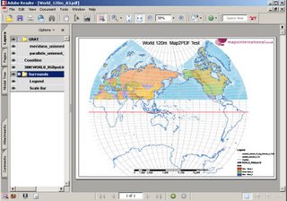
A GeoPDF that supports Layers and is Georeferenced with the Acrobat Reader.
(though did struggle with the 1GB Tiff of the World -which was reprojected on the fly in ArcGIS)
Version 3 is now available
features are:-
* Support for multiple raster layers
* Support for transparent layers
* Compatibility with third party products such as DS Mapbook and PLTS for batch GeoPDF export
* Support for ArcServer and ArcEngine
* Visual Basic access to MAP2PDF functions
* Preservation of the ESRI grouped layer structure
* Expanded datum support
* Support of user-defined datums
* Saving of MAP2PDF parameters with the MXD file
* Map grid and map surrounds exported as separate layers
* Enhanced rasterization allowing additional PDF optimization. Raster imagery is now stored as x objects and thus can be compressed using Acrobat Pro’s Optimization or Reduce File Size command, significantly reducing the size and enhancing the performance of the PDF file.
Though ArcReader is Free - ArcPublisher is not, this has a cost but can be easy distributed using Arcobat Reader
1 Comments:
looks like a very useful tool. I am currently evaluating products for distributing preconfigured interactive maps over the Internet in Indonesia, so bandwidth is a big issue!
Does anyone have experience with comparative filesizes that Map2PDF and ArcGIS Publisher create?
Post a Comment
<< Home